
Stu drove Joan to the Las Vegas airport for her 10:30 am flight home to FL, and then returned to Lake Mead. He was preparing to drive the trailer to Portland, Oregon where it will stay for a month.
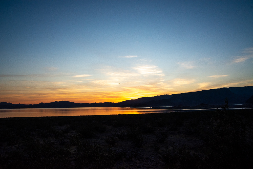
6.11 to 6.13 Lake Mead Camping
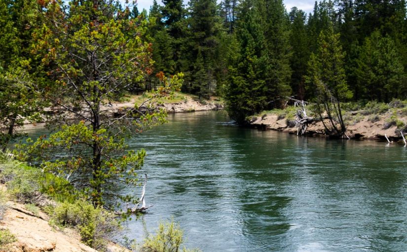
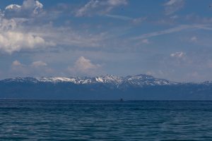
Lake Mead is formed by Hoover Dam in a barren area nearly devoid of trees and any natural life. The dam kept it barren, empty and very hot. The “beach” is boulder strewn and while the water is comfortable, walking requires shoes.
6.12 Tour the Hoover Dam Power Plant
Hoover Dam is hard to visualize – from above, it is so large my eye sees only a miniature representation of the structure.

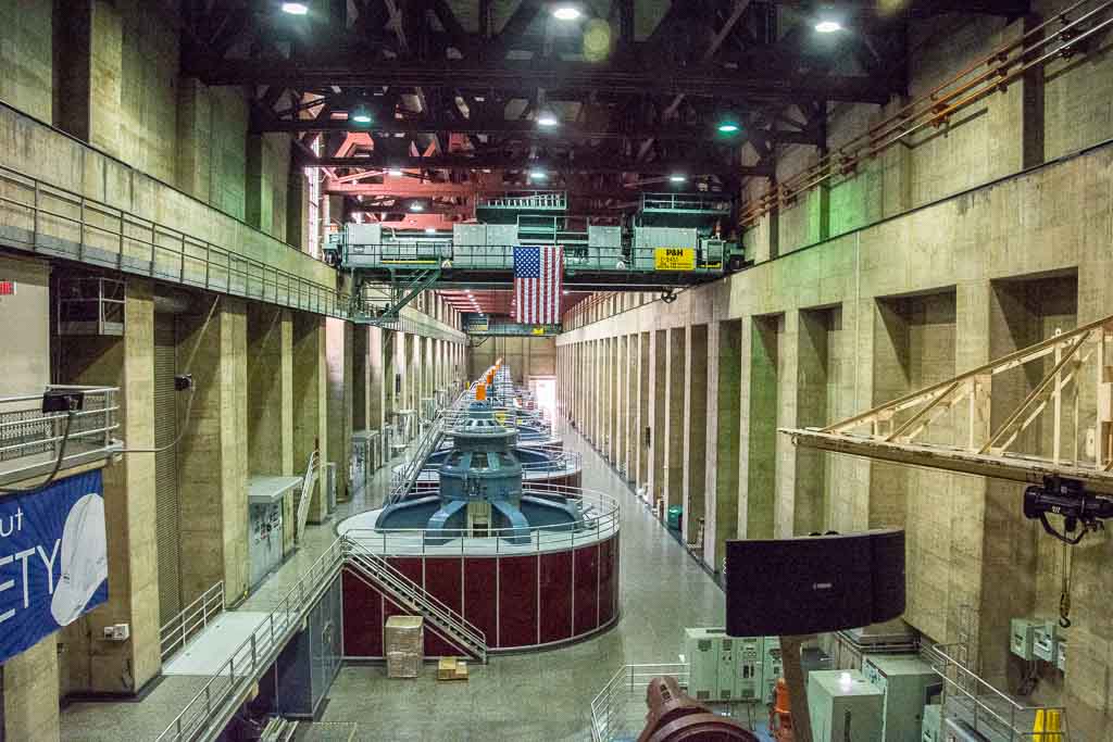
Everything in the power plant was invented to meet the unique needs of such a large project.
Calvin Coolidge and Herbert Hoover negotiated with seven states and Mexico to iron out the water rights for the Colorado River so they could build the dam.
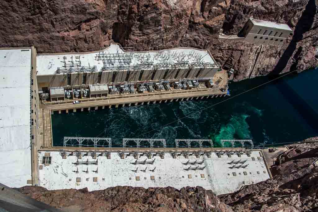
The concrete was poured in one continuous piece, 24 hours a day for nearly two years. Two concrete plants were built on location because transportation of that volume of concrete was impossible. This is the rough equivalence of starting Interstate 95 in Maine and pouring 24 hours per day until the equipment, invented for the purpose, arrived in Florida. During the pouring process, concrete radiates significant heat so in addition to pouring, a combination of river water and refrigerated water was pumped through the dam to keep it from cracking under the heat.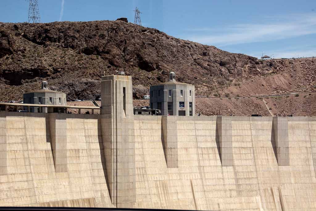
The generators and switches were the largest ever made and had to be assembled on site with the largest cranes ever built. Even the pipe was so large it had to be cast in place. Each of the nine generators produces about 250 million watts with the total producing nearly 2 billion (gigawatts), or about what a large nuclear power plant can make. They have stood the test of long time and continuous usage. All nine of the original full-size generators are still producing power with only the originally planned maintenance being required. Imagine running your car for a million miles with no service except oil changes.
Politics being what they were, two local governments decided to buy their own, different, generators. Just as you might buy your one engine for an airplane – these two are no longer running and the generator control was centralized years ago.
As far as your eye can see with these generators, the dam is actually taller and the concrete is thicker.
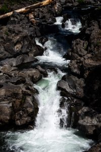
Water from the Colorado River is impounded to create the dam that provides the falling water to generate the electricity. Once the power is extracted by dropping the water level about 500 feet, it exits from the tail piece with some remaining force. In the background of the photo are the boats that routinely enjoy the exiting water in the relative calm of the lower Colorado.
6.13 to 6.14 Lake Diaz
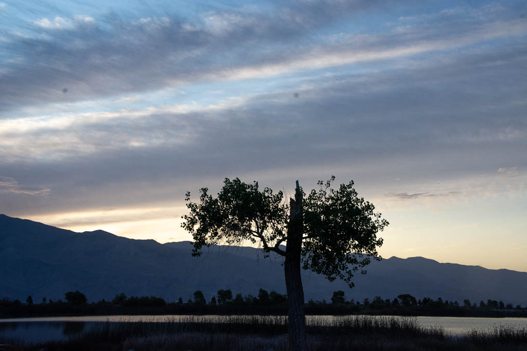
There is nothing much to do or say about Lake Diaz. It is shallow, muddy, still, uninteresting and judging from the fishermen, unpopulated. The sunrise over the mountains, at 5:30 in the morning, is the best part.
After the sunrise, the next best part is the sunset over “the tree.” My site had one of 3 trees in the park, a poor scrub of a lightning-struck tree that was struggling to survive in the absence of rain and in sandy/rocky soil. The campground had no water, no power, no utilities, no beach on the lake, and not much going for it.
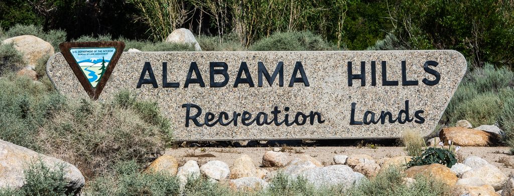
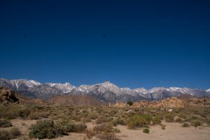
Lake Diaz’ claim to attract visitors is primarily due to the proximity to Mt. Whitney.
6.14 Mt. Whitney
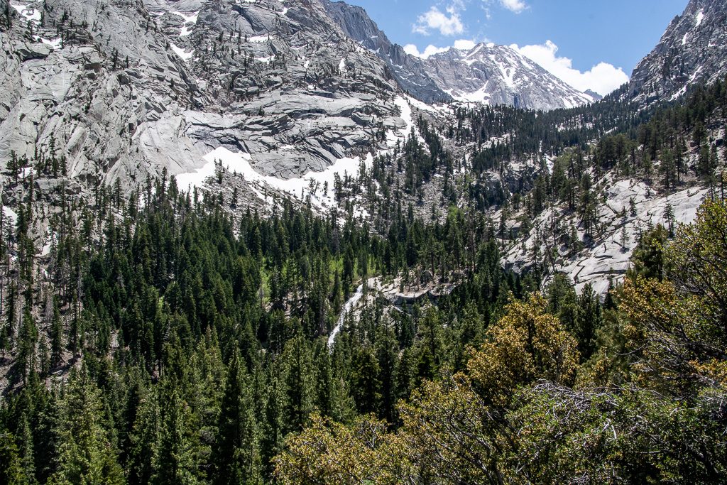
I wish I could say, “I climbed Mt. Whitney,” but that implies I climbed to the top. Actually, at about 11,000 feet, my age, lack of air, and heights led me to turn back and down to the trailer parked at 8,400 feet. This is not the ending of the story.
The road climbed at a 6% or more grade up to about 8,000 feet. The car, now named Acadia, demanded a rest a few times to look over the scenery. We averaged about 25 miles per hour climbing to the Whitney Portal:
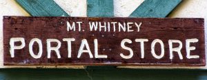
Mt. Whitney Portal Store is famous for its location at the base of the Mt. Whitney portal, the climb to the base camp, and ultimately the top of the Mountain. Locally, it is even better known for the giant hamburgers and huge tasty pancakes. The picnic table I chose was ultimately occupied by a fellow traveler who ordered one of these pancakes: 14 inches in diameter and 1 inch thick it looked lovely but impossible to eat at one setting.
I was the lucky recipient of one half of one quarter of the pancake serving, enough for a satisfying breakfast that easily lasted until dinner time and supported 5 miles of hiking.
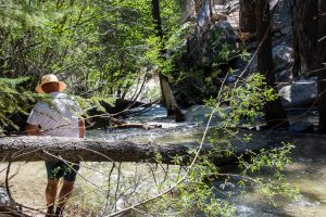
As good as breakfast was, the best part of the day was the attempted climb to the 11,500 foot base camp of Mt. Whitney. As a sea-level Florida person, I just wasn’t up to the climb. The thought of the 5,000 foot cliff and the thinner air made me dizzy and after sitting a while, I started back. On the way, several families with very young children (spares?) passed me, both coming up and going back down.
6.14 Lee Vining and Mono Lake Campground

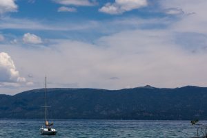
Lee Vining and Mono Lake Campgrounds were places to pass through. South Lake Tahoe was a beautiful lake. I explored the coast, waiting for the campsite to become available.
6.18 to 6.20 Crater Lake National Park
Crater Lake was created suddenly about 7,000 years ago when a massive volcano ran out of lava and collapsed. Wizard Island was created shortly after Crater Lake when the lava partially re-filled underground, creating a mountain within the crater.
The blue color is “natural,” caused by the extremely pure water. Crater lake is filled with snowmelt and rain water, no streams feed the lake.
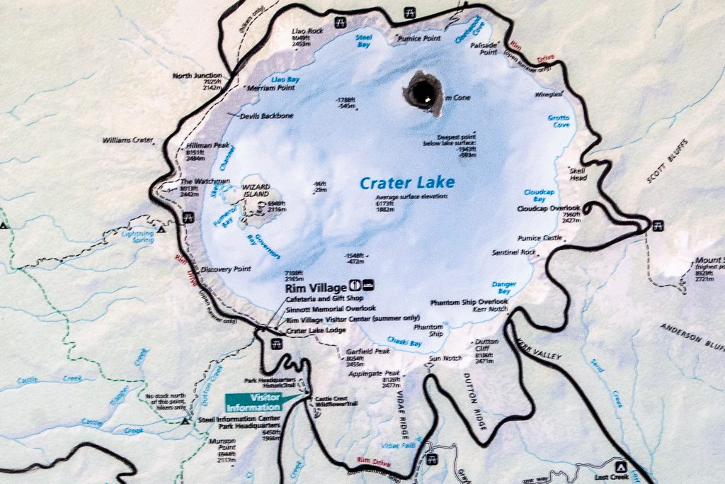
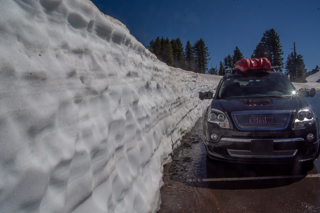
Among the many attractions of Crater Lake are the children in summer clothes playing in the snow. The ranger said the snow was 40′ deep on portions of the roadway that are still closed. Several snow plows were working when I visited the area.
As I drove higher into the caldera, remains that enclosed Crater Lake, the snow became deeper. In one recently plowed area, I could drive up to the remains of a drift, that after months of melting, was still above the car.
There are a number of Forest Service campgrounds within Crater Lake. I decided to get a campground with electricity and WiFi so I would be warm at night and communicate. I also wanted to do the pages describing the area while the fabulous scenes were fresh in my mind.
I stayed at Crater Lake RV Campground. It used to be named Prospect Campground – the Crater Lake name ensures it is almost always full. It happens to have excellent fiber optic WiFi. This page is the result.
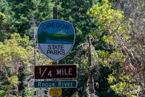
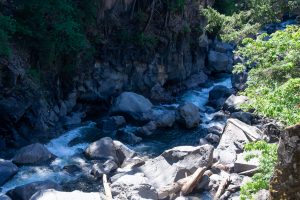
The best part of the campground is it is close to Rogue River, an apparently well known white water competition river for skilled, brave kayakers. My kayak stayed on the roof; I’m nowhere skilled enough, and bravery just barely lets me look at the heights.
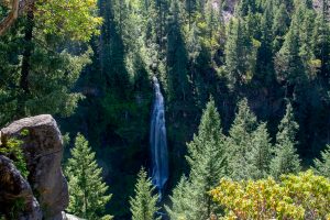
The nice folks at the campground gave me a map and urged me to hike out to see the falls. Five miles of bicycling and 90 minutes of hiking proved they were right.
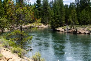
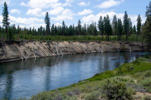
6.20 to 6.22 LaPine State Park and Deschutes River
LaPine State Forest was a very quiet campsite. Each site was far from any other, lightly used, and quiet (did I say quiet). The sites were surrounded by hiking trails and I even got to see a bear in the distance.
6.22 to 6.25 Viento State Park
Viento State Park is very popular because of the wind in the Columbia Gorge. The wind carries the stabilized canoes, kayaks and surfboards upstream from Viento to Hood River in a rapid, exciting trip that demands skill (well beyond mine) and some luck.
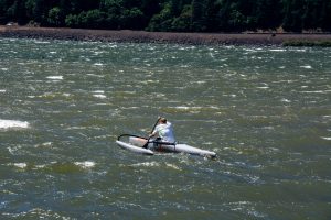
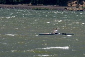
I was standing on the shore, looking at the Columbia River that Joan, Sheila, Bob and I will be cruising next month. Sure glad we are going with the wind!
6.23 Town of Hood River, Mt Hood Railway, and Big Windsurfing
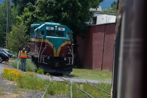
I detached the trailer and drove into the town of Hood River, hoping to have my bicycle repaired after the chain fell off yesterday climbing a very steep hill. I was fortunate to find Mountain View Cycles, a shop specializing in high performance mountain bikes. They had time to fix the damage, do a full tune up, and clean and oil the bike for $25.
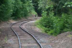
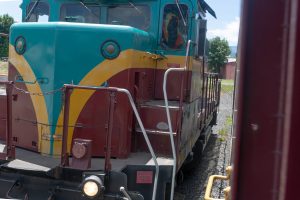
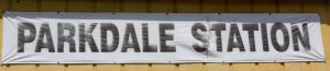
All this was done while I took an excursion on the Mt Hood Railroad. A trip back in time to Parkdale, a town that had folded when the lumber industry ran out of forest and is rebuilding itself as a tourist destination. Small but lovely.
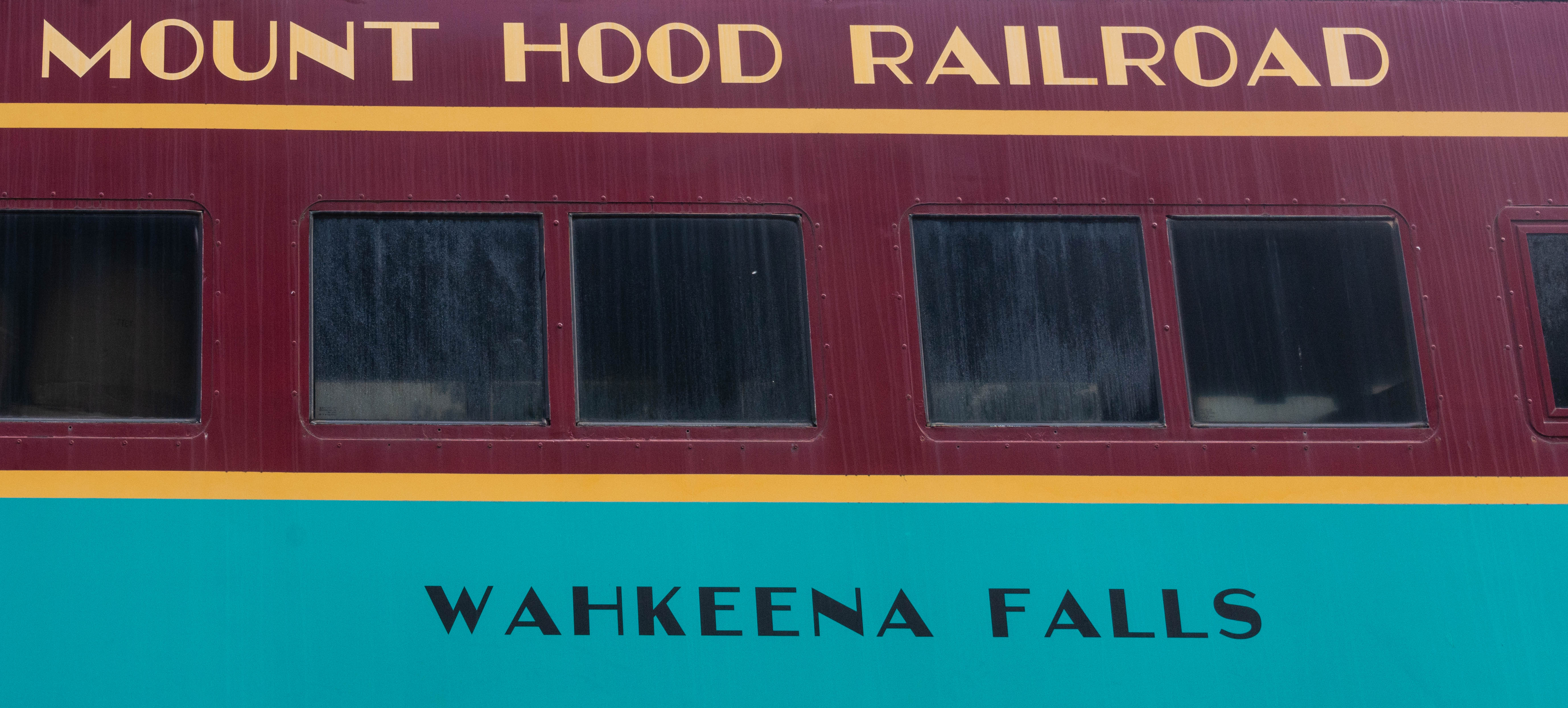
I took the mid-day excursion on the “restored” Mount Hood Railroad. The five-hour round trip – with an hour off for lunch – was $35. They permitted passengers to go from car to car, and photography was encouraged. Unfortunately, there was not much interesting to see – just trees, some half hidden cliffs, and the Hood River, far below the rail bed.
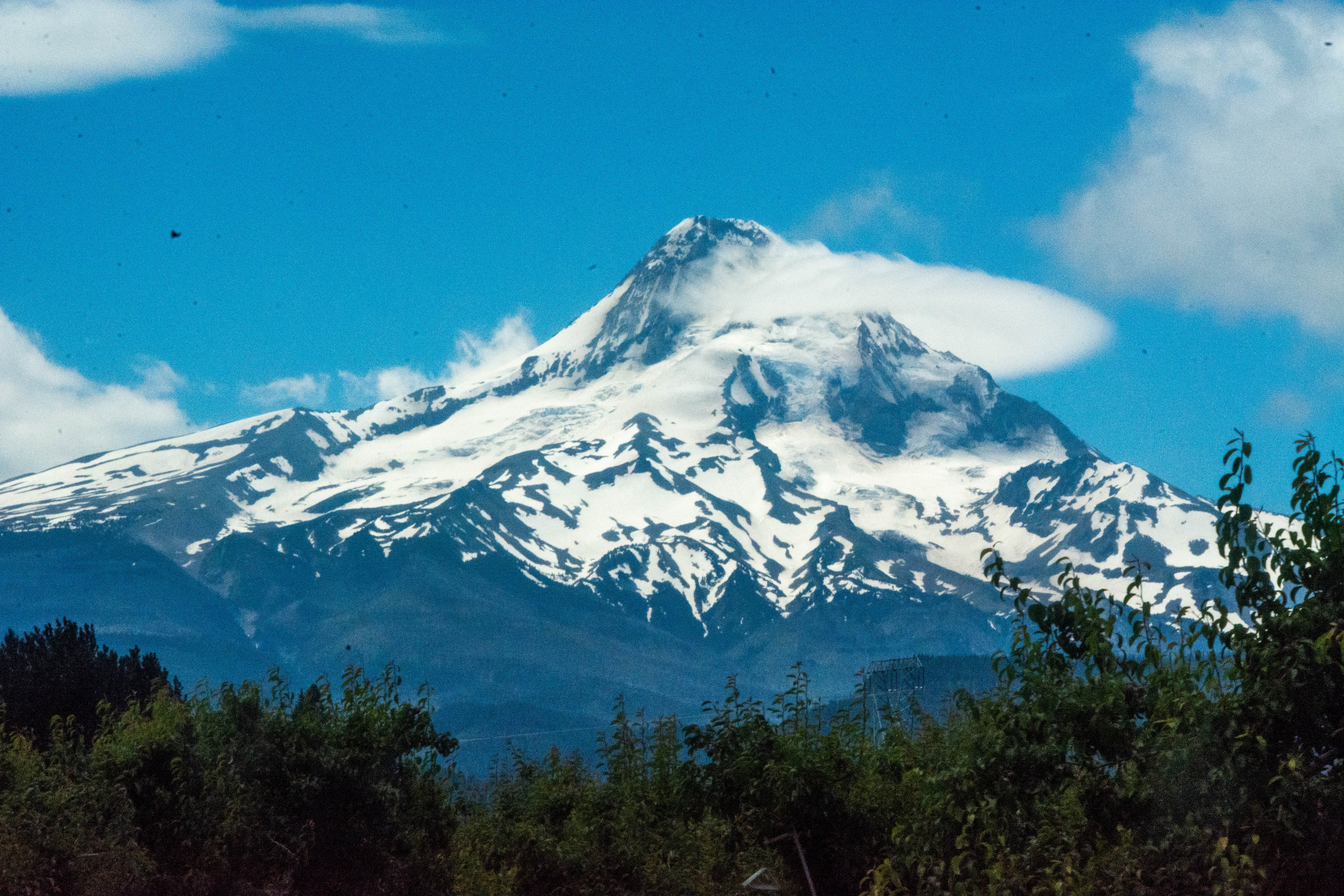
The high point of the day was when we spotted Mt Hood in the distance.
The trip was summarized by nearly everyone sleeping on the trip back to the town of Mt. Hood.
Finally, the surprise of the day was the Kitesurfing and Windsurfing contest they were conducting at the waterfront. Wow.
6.24 Travel the Historic Columbia River Highway
Viento Campground is perfectly situated for tourists. Located halfway between the lively town of Hood and the Historic Columbia River Highway, the campground became the base for two day explorations. I unhitched the trailer and traveled the highway very slowly, looking for the perfect waterfall.
So did nearly everyone else in Portland. It was a beautiful day to play hookey, do some hiking, and take lots of photographs. The hikes available ranged from paved, nearly flat trails to hikes beyond my skill and strength. I took a long bicycle ride and four of the hikes ranging up to about 7 roundtrip miles.
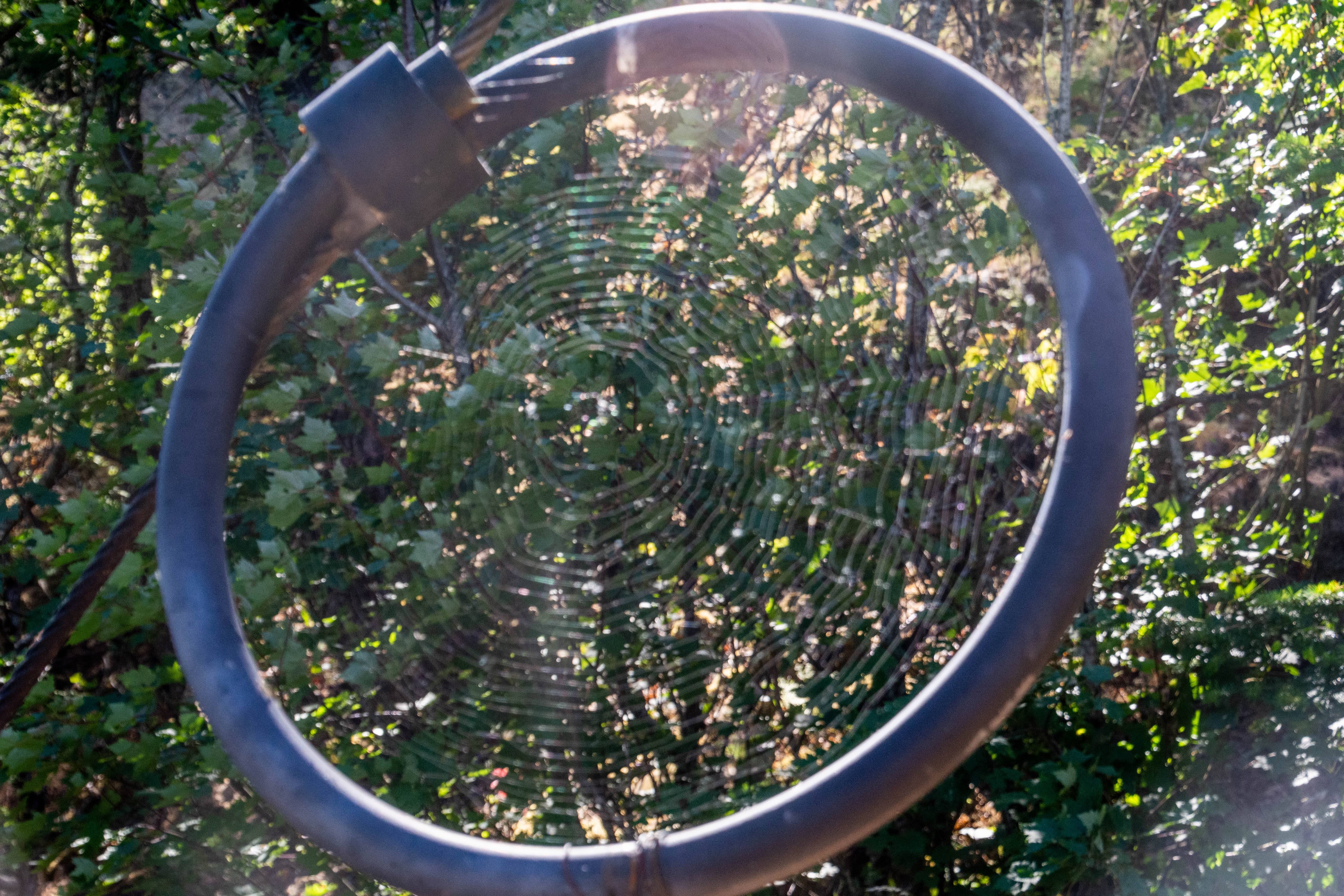
Part of the paved bicycle trail ran along some very high cliffs that were occasionally dropping some rocks and boulders. To protect the walkers and bikers there was a very strong wire mesh fence on the side of the trail. The fence was supported by very, very strong cable that was looped at each end to provide break-away shock relief in case of a major rock fall. A spider had constructed a web completely within the 18″ diameter wire loop. The web was very productive.
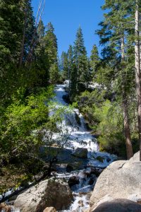
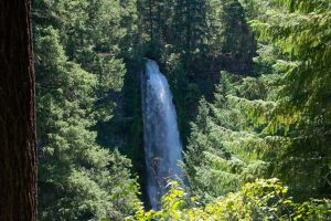
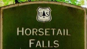
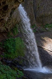
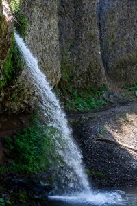
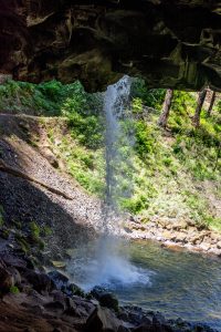
My favorite set of waterfalls along the trail are Horsetail Falls. There were two falls, an easy one to observe from the nearby parking lot (I was lucky this time and found a spot). The higher falls was about 90 minutes above the lower falls and took some scrambling to reach it.
Two branching falls were closed due to recent fire set by a teenager playing with fireworks.
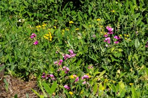
Everywhere I bicycled and walked there were flowers. More than I ever expected to see in a rocky area that is a desert part of the year and nearly drowns with rain the rest of the year. It is hard to encompass the beauty of the trails. I frequently had to stop and just absorb the colors.

6.25 To Columbia RV Park
Columbia RV Park is a residential park (unlike a camping park) that is mostly permanent residents. There were larger pad areas, no picnic tables, and few amenities except a laundry area. The park was VERY CONVENIENT. It is located on a series of bike routes enabling me to ride and see portions of the river, the hotel where we would be leaving the “rig,” and the dock where our cruise ship would be delivering us in about a month.
6.26 Visit to Portland
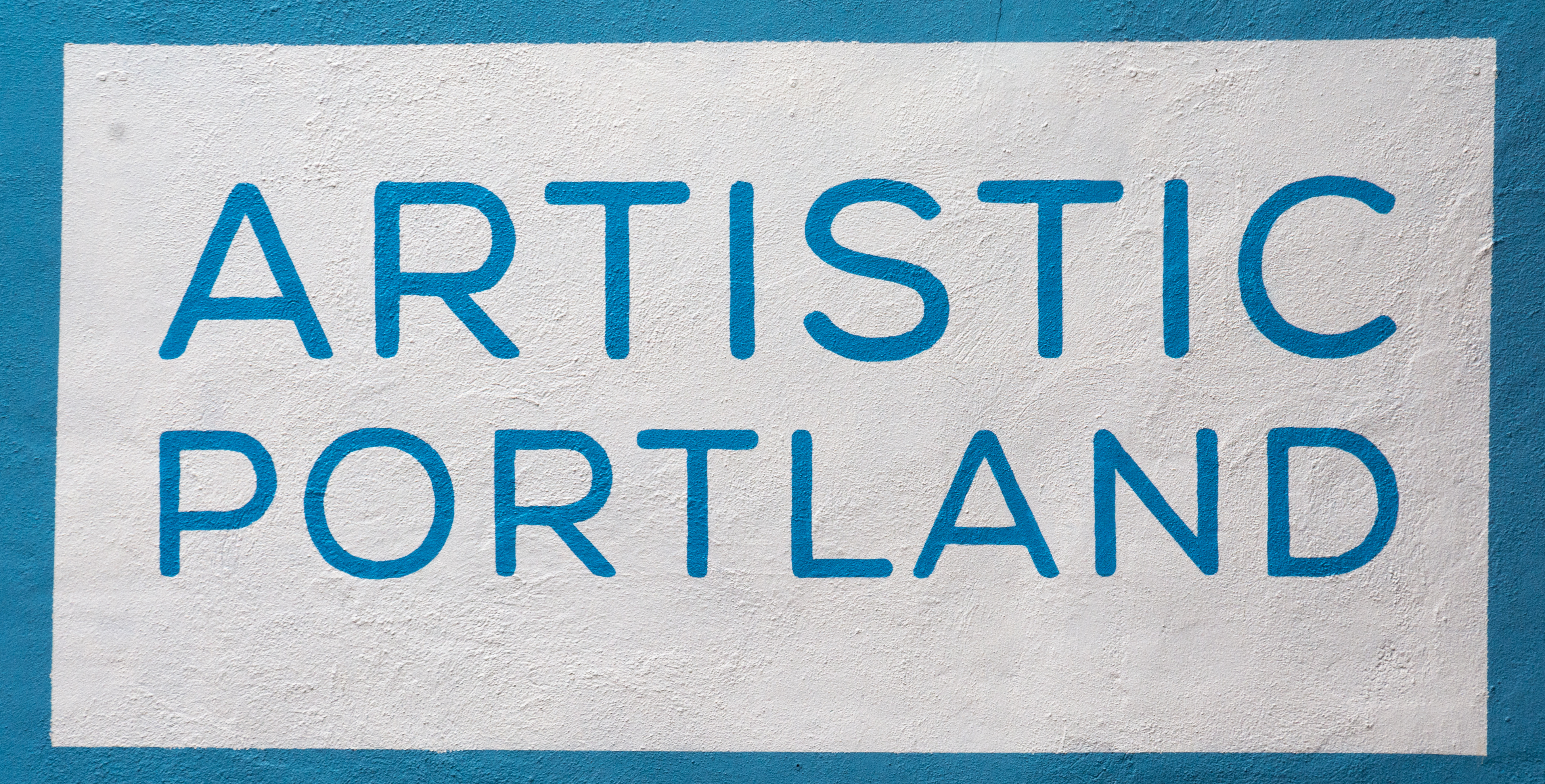
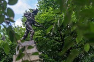
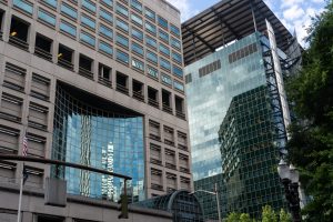
Portland is a beautiful city. It was located about 8 congested road miles from the campground, but once I dealt with the traffic, the city encouraged walkers and bikers. Cities display art in several ways that catch my eye. Portland has its share of public spaces with statues that provide places for people to congregate, relax, and enjoy the outdoors near where they work.
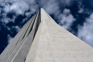
Cities also provide architecture in the form of beautiful (or at least functional) buildings. Portland limits the height of buildings so architects are challenged to create striking buildings in smaller spaces.
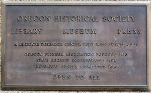
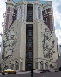
The Oregon Historical Society had interesting building decorations with a truly captivating use of public space, gardens, and technique. I do wish I had budgeted a full day on their grounds.
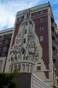
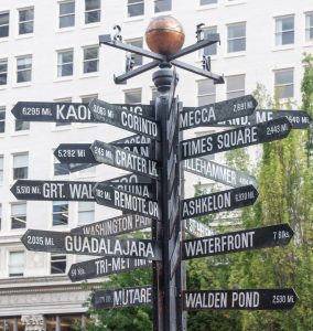
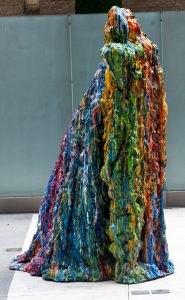
There was ample street art in Portland. Some of it was especially interesting including the sign that helped tourists figure out where they were. My favorite art reminded me of when my mother and I used to sit on the beach and build drip castles. Our castles were ephemeral but the memories were forever. These aren’t forever, but they will last a long time.
I love to walk. However, when Joan and I enter a city that is new to us, we try to find a local Hop-On-Hop-Off.

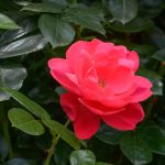
Portland has a Hop On that gives a picture of the city that can only be gained from an experienced guide. We generally take a full loop around a new city and pick a few stops to Hop Off and visit. I choose an aerial tramway and the Rose Garden before exiting the Hop On and walking through the city a second time.
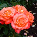
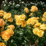
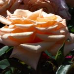
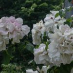
The Rose Garden is amazing.

Portland is known worldwide for the Spring rose judging. Entrants send their roses to Portland where they are judged, awarded ribbons, and the finest planted in the garden for everyone to enjoy.

6.27 Time to fly home
I delivered the car and trailer to the parking lot of the Red Lion Hotel, Portland where Joan had negotiated a place for parking the rig. The trailer and car will stay for a month while I flies home for 2 weeks, then we both fly back to Spokane for our American Cruise Line cruise with Bob and Sheila Bell – down the Snake and Columbia Rivers back to Portland. Leg 3 of our trip starts in Spokane, Washington on July 16.